See the Driving Tour:

The Canyon Section
The Quemahoning Section

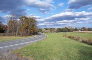
You don’t have to be a whitewater enthusiast, hiker, cyclist, biker or fisher to experience the best that The Stonycreek Corridor has to offer. You can drive to its primary attractions and see many of the corridor’s most-interesting features with short walks from your parking places!

This driving tour is 22 miles in total length from start to finish and takes you to nine points of interest. You can either begin your tour at Greenhouse Park or at Quemahoning Dam. Information is provided on each stop. Latitude and longitude coordinates are provided for those who wish to use GPS units, and directions are included for everyone else. To get started, simply download the driving tour information sheets in the order in which you wish to take your tour. Then go for a drive!

Garmin users, download your tour routes and points of interest here:

Tour Route
Points of Interest

Magellan users, download your tour routes and points of interest here:

Tour Route
Points of Interest

From Greenhouse Park to Quemahoning Lake:

Stop #1: Greenhouse and Whitewater Parks

Stop #2: Yoder Falls

Stop #3: Carpenter’s Park

Stop #4: Mine 40 Overlook

Stop #5: Windber National Register Historic District

Stop #6: Foustwell

Stop #7: Benson/Hollsopple

Stop #8: Oven Run

Stop #9: Quemahoning Dam

From Quemahoning Lake to Greenhouse Park:

Stop #9: Quemahoning Dam

Stop #8: Oven Run

Stop #7: Benson/Hollsopple

Stop #6: Foustwell

Stop #5: Windber National Register Historic District

Stop #4: Mine 40 Overlook

Stop #3: Carpenter's Park

Stop #2: Yoder Falls

Stop #1: Greenhouse and Whitewater Parks


Copyright ©2008 Stonycreek Quemahoning Initiative
Site Designed by Hurst Media Works, KH2 Design, FisherWorks Consulting and Recharge Web Design