View Larger Map
| You’ve completed the tour. Now that you know your way around, visit often! |
|
Latitude: 40.1819
Longitude: -78.9447
View Map
Print-friendly version
Driving Tour Stop #9
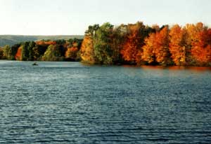
Quemahoning Lake began as an industrial water-supply reservoir for the Cambria Iron and Steel Company of Johnstown, serving steel-making needs from 1912 until its sale to an authority, formed by Cambria and Somerset counties, in 2000. For most of that period the Que (pronounced “kwee” by the locals) was owned by a subsidiary of Bethlehem Steel Corporation, Cambria’s successor, and was closed to the public. Bethlehem management employees enjoyed a private, lakeshore resort here called Bethco Pines.
Upon the sale of Quemahoning and four other dams to the Cambria Somerset Authority, the public now owns this 12 billion-gallon lake with 880 acres of surface area and 11 miles of shoreline, surrounded by almost 2,400 acres of land. The former Bethco Pines property was leased to a summer camp, Summer’s Best Two Weeks, which razed the deteriorated Bethco buildings and built new facilities in their place. Through a cooperative, contractual arrangement with the Cambria Somerset Authority, Summer’s Best Two Weeks develops and manages the Quemahoning Family Recreation Area in exchange for rent-free use of the former Bethco Pines property.
Through this arrangement the public now has boat and canoe launches, a swimming beach, a picnic area with pavilions, athletic playing fields, basketball and volleyball courts, a walking trail, a playground, horseshoe pits and campsites for tents and RVs.
The Pennsylvania Fish & Boat Commission has jurisdiction over Quemahoning Lake and requires that all boats be registered and all fishers age 16 and over be licensed.
Related Websites:
|