 |
State-owned
resources, managed for hunting by the Pennsylvania Game
Commission, include:
- Forbes State Forest, which straddles Laurel Ridge in
the southwest corner of the corridor south of U.S. Route
30.
For more information.
- Gallitzin State Forest, which is located in the
northeast corner of the corridor along both sides of PA
Route 56.
For more information.
- Laurel Ridge State Park, which contains the Laurel
Highlands Hiking Trail that extends for 70 miles from
Ohiopyle State Park to Johnstown. Most of the park is
open to hunting.
For more information.
- Pennsylvania Game Land #42, which sits atop Laurel
Ridge. Portions extend along the eastern slope north of
U.S. Route 30 within the corridor.
For more information.
- Pennsylvania Game Land #228, which is located on the
eastern side of the corridor north of U.S. Route 30 and
west of Central City.
For more information.
|
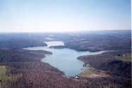 |
Cambria
Somerset Authority permits hunting on practically all
of its 3,275 acres, where resources are managed by the
Pennsylvania Game Commission. On the lakeside of Quemahoning
Dam Road in the vicinity of the Family Recreation Area and
Summer's Best Two Weeks camp, hunting is restricted to
waterfowl only, and a special safety zone permit must be
obtained by contacting Summer's Best Two Weeks.
For more information.
|
|